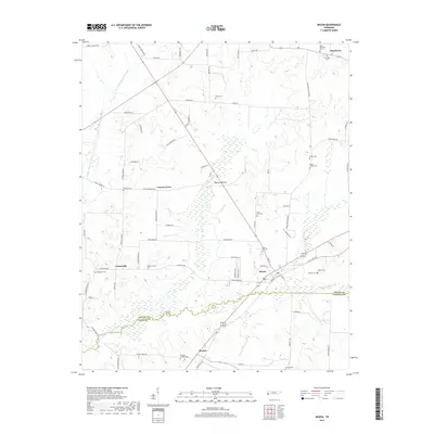
2019 Map of Mason
USGS Topo · Published 2019About this map
Mason and Braden anchor the southern portion of this landscape, where the flatlands of West Tennessee are defined by the winding boundary between Tipton Co and Fayette Co. The terrain is marked by significant hydrological engineering, including the Little Beaver Cr Canal and Middle Beaver Cr Canal, which channel water through the low-lying Baxter Bottom. These drainage efforts support a rural agricultural economy that has persisted for generations, evidenced by the numerous small settlements and family-named landmarks scattered across the landscape.
Find a feature on this map
77 named features on this map. Tap any name to fly to it.
Don’t see what you’re looking for? This feature index may not catch every label — zoom into the map to look around manually.
Map Details
Editions of this 2019 Mason Map
This is the sole edition of this map. No revisions or reprints were ever made.
Other maps of this area

1952 · Stanton
USGS Topo · 1:24,000

1952 · Lambert
USGS Topo · 1:24,000

1952 · Stanton
USGS Topo · 1:62,500

1954 · Mason
USGS Topo · 1:62,500

1956 · Blytheville
USGS Topo · 1:250,000

1959 · Blytheville
USGS Topo · 1:250,000

1961 · Rialto
USGS Topo · 1:62,500

1962 · Rialto
USGS Topo · 1:62,500
1964 · Turnpike
USGS Topo · 1:24,000

1965 · Brighton
USGS Topo · 1:24,000