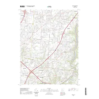
2023 Map of Mason
USGS Topo · Published 2023About this map
The Little Miami Wild and Scenic River defines the southeastern corner of this map, winding through a landscape where suburban expansion meets historic crossroads. The map documents the dense network of subdivisions and major thoroughfares like Tylersville Rd and Fields-Ertel Rd that have reshaped the area. Genealogists will find several burial grounds preserved amidst the development, including the Rose Hill Cem and the Cline Family Cem.
Find a feature on this map
68 named features on this map. Tap any name to fly to it.
Don’t see what you’re looking for? This feature index may not catch every label — zoom into the map to look around manually.
Map Details
Editions of this 2023 Mason Map
This is the sole edition of this map. No revisions or reprints were ever made.
Other maps of this area

1898 · East Cincinnati
USGS Topo · 1:62,500

1904 · Mason
USGS Topo · 1:62,500

1906 · Mason
USGS Topo · 1:62,500

1914 · East Cincinnati
USGS Topo · 1:62,500

1914 · Batavia
USGS Topo · 1:48,000

1914 · Morrow
USGS Topo · 1:62,500

1916 · Batavia
USGS Topo · 1:62,500

1916 · Morrow
USGS Topo · 1:62,500

1953 · Goshen
USGS Topo · 1:24,000
1953 · Madeira
USGS Topo · 1:24,000