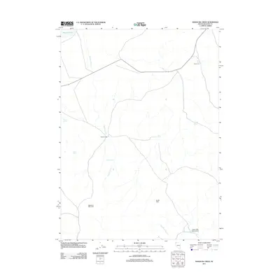
2011 Map of Massacre Creek
USGS Topo · Published 2011About this map
Massacre Ranch and Coyote Camp serve as the primary human touchpoints in this arid corner of northwestern Nevada. The landscape is defined by its scarce water sources, where named springs such as Emigrant Spring, Coyote Spring, and Trough Spring dictate the movement of people and livestock. These vital watering holes, along with Massacre Spring, are scattered across a high-desert terrain marked by the ephemeral Massacre Lake in the northwest. Significant geological landmarks anchor the territory, including the prominent Massacre Mountain and the distinct formation of Bruffs Rock. To the south, the deep topography of Upper High Rock Canyon and the course of High Rock Creek reveal the drainage patterns of this high basin and range environment, illustrating how the natural hydrology of Massacre Creek has historically shaped land use and ranching boundaries.
Find a feature on this map
14 named features on this map. Tap any name to fly to it.
Don’t see what you’re looking for? This feature index may not catch every label — zoom into the map to look around manually.
Map Details
Editions of this 2011 Massacre Creek Map
This is the sole edition of this map. No revisions or reprints were ever made.
Other maps of this area

1889 · Long Valley
USGS Topo · 1:250,000

1954 · Vya
USGS Topo · 1:250,000

1958 · Vya
USGS Topo · 1:250,000

1962 · Vya
USGS Topo · 1:250,000

1966 · Badger Mtn NW
USGS Topo · 1:24,000

1966 · Massacre Lake NW
USGS Topo · 1:24,000

1966 · Massacre Lake
USGS Topo · 1:24,000

1966 · Nut Mountain
USGS Topo · 1:24,000

1966 · Massacre Creek
USGS Topo · 1:24,000

1966 · Painted Point
USGS Topo · 1:24,000