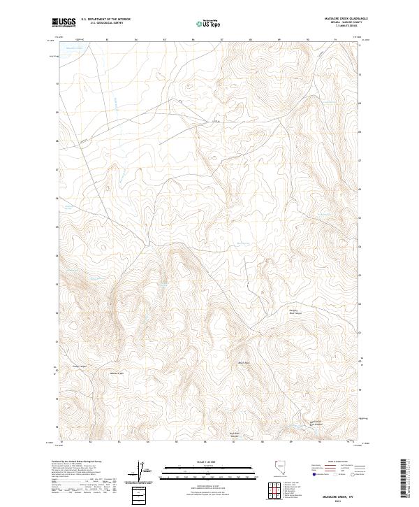
2021 Map of Massacre Creek
USGS Topo · Published 2021About this map
Massacre Mtn anchors this high desert landscape, where water sources defined historical movement across the Great Basin. Named for a site of historical conflict, the region is characterized by narrow drainages like Grassy Canyon and the prominent Bruffs Rock. While modern roads NV 8a and Co Rte 8a cross the northern flats near Massacre Lake, the southern terrain becomes significantly more complex. Deep, steep-walled passages such as Hanging Rock Canyon, High Rock Canyon, and Upper High Rock Canyon reveal a geography that once dictated the paths of travelers. A network of vital water points, including Emigrant Spring, Massacre Spring, and Willow Spring, suggests the locations of essential stops for those navigating this arid environment.
Find a feature on this map
24 named features on this map. Tap any name to fly to it.
Don’t see what you’re looking for? This feature index may not catch every label — zoom into the map to look around manually.
Map Details
Editions of this 2021 Massacre Creek Map
This is the sole edition of this map. No revisions or reprints were ever made.
Other maps of this area

1889 · Long Valley
USGS Topo · 1:250,000

1954 · Vya
USGS Topo · 1:250,000

1958 · Vya
USGS Topo · 1:250,000

1962 · Vya
USGS Topo · 1:250,000

1966 · Badger Mtn NW
USGS Topo · 1:24,000

1966 · Massacre Lake NW
USGS Topo · 1:24,000

1966 · Massacre Lake
USGS Topo · 1:24,000

1966 · Nut Mountain
USGS Topo · 1:24,000

1966 · Massacre Creek
USGS Topo · 1:24,000

1966 · Painted Point
USGS Topo · 1:24,000