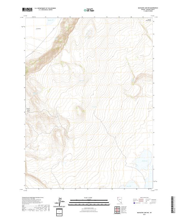
2021 Map of Massacre Lake NW
USGS Topo · Published 2021About this map
Long Valley stretches across this high-desert terrain in northern Washoe County, where seasonal hydrology and remote springs define the landscape. The Painted Point Range dominates the topography, providing a stark backdrop to the series of basins and flats that catch intermittent runoff. Water sources are critical landmarks in this arid environment, represented by named features such as Indian Spring, Townsend Spring, and Sheep Camp Spring. In the northern and southern reaches of the quadrangle, Middle Lake and West Lake serve as primary focal points for the drainage patterns of the valley. This 2021 survey illustrates a region largely shaped by the Public Land Survey System, with the boundaries of t44n r20e and t43n r21e cutting across the open range. Navigation through this territory is limited to a few secondary routes like CR 34, which traces the contours of the valley floor.
Find a feature on this map
14 named features on this map. Tap any name to fly to it.
Don’t see what you’re looking for? This feature index may not catch every label — zoom into the map to look around manually.
Map Details
Editions of this 2021 Massacre Lake NW Map
This is the sole edition of this map. No revisions or reprints were ever made.
Other maps of this area

1889 · Long Valley
USGS Topo · 1:250,000

1954 · Vya
USGS Topo · 1:250,000

1958 · Vya
USGS Topo · 1:250,000

1962 · Vya
USGS Topo · 1:250,000

1966 · Bald Mountain
USGS Topo · 1:24,000

1966 · Massacre Lake NW
USGS Topo · 1:24,000

1966 · Vya
USGS Topo · 1:24,000

1966 · Massacre Lake
USGS Topo · 1:24,000
1966 · Mosquito Valley
USGS Topo · 1:24,000
1966 · Calcutta Lake
USGS Topo · 1:24,000