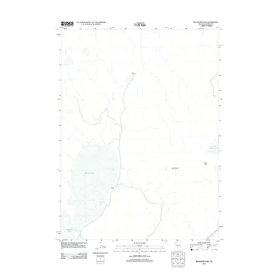
2011 Map of Massacre Lake
USGS Topo · Published 2011About this map
Massacre Lake dominates this high desert landscape in northwestern Washoe County, where seasonal water and flat-topped volcanic features shaped the movement of early travelers and ranchers. The presence of Evans Camp and Black Camp reflects the region's history of cattle ranching and seasonal encampments. The terrain is defined by distinct topographical markers such as Table Butte and Bitner Table, which provided high-ground navigation points across the basin. Water resources, though sparse, are anchored by the Massacre Creek drainage and the isolated Willow Spring. To the east, the smaller basin of Fatty Martin Lake sits below the volcanic plateaus, illustrating the unique hydrologic character of the Great Basin's ephemeral lake systems in the early 21st century.
Find a feature on this map
8 named features on this map. Tap any name to fly to it.
Don’t see what you’re looking for? This feature index may not catch every label — zoom into the map to look around manually.
Map Details
Editions of this 2011 Massacre Lake Map
This is the sole edition of this map. No revisions or reprints were ever made.
Other maps of this area

1889 · Long Valley
USGS Topo · 1:250,000

1954 · Vya
USGS Topo · 1:250,000

1958 · Vya
USGS Topo · 1:250,000

1962 · Vya
USGS Topo · 1:250,000

1966 · Bald Mountain
USGS Topo · 1:24,000

1966 · Swan Lake
USGS Topo · 1:24,000

1966 · Badger Mtn NW
USGS Topo · 1:24,000

1966 · Massacre Lake NW
USGS Topo · 1:24,000

1966 · Massacre Lake
USGS Topo · 1:24,000

1966 · Nut Mountain
USGS Topo · 1:24,000