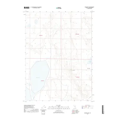
2018 Map of Massacre Lake
USGS Topo · Published 2018About this map
Massacre Lake dominates the high desert landscape of northwestern Nevada in this 2018 survey. The area is characterized by intermittent water sources and dramatic topographic rises, including the prominent Table Butte and the broad elevation of Bitner Table. These features suggest a terrain where seasonal hydrology dictates the local character, as seen in the drainage of Massacre Cr and the presence of smaller catchments like Fatty Martin Lake. Human presence is sparse, represented primarily by Co Rte 8a, which skirts the southeastern corner of the quadrangle. This detailed topographic data provides a record of the basin's natural landmarks, from the vital Willow Spring in the northeast to the sprawling alkali flats of the main lake bed, which remains a focal point for those studying the remote geography of Washoe County.
Find a feature on this map
11 named features on this map. Tap any name to fly to it.
Don’t see what you’re looking for? This feature index may not catch every label — zoom into the map to look around manually.
Map Details
Editions of this 2018 Massacre Lake Map
This is the sole edition of this map. No revisions or reprints were ever made.
Other maps of this area

1889 · Long Valley
USGS Topo · 1:250,000

1954 · Vya
USGS Topo · 1:250,000

1958 · Vya
USGS Topo · 1:250,000

1962 · Vya
USGS Topo · 1:250,000

1966 · Bald Mountain
USGS Topo · 1:24,000

1966 · Swan Lake
USGS Topo · 1:24,000

1966 · Badger Mtn NW
USGS Topo · 1:24,000

1966 · Massacre Lake NW
USGS Topo · 1:24,000

1966 · Massacre Lake
USGS Topo · 1:24,000

1966 · Nut Mountain
USGS Topo · 1:24,000