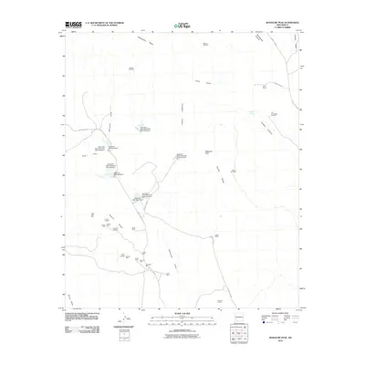
2010 Map of Massacre Peak
USGS Topo · Published 2010About this map
Massacre Peak anchors this landscape in Luna County, where the high desert is marked by an extensive legacy of resource extraction and transit history. The map highlights the historic route of the Butterfield Trl cutting through the Pony Hills, while Cookes Spring and Cookes Canyon denote critical water and passage points in a dry environment. The southern portion of the quadrangle is dominated by the complex geology of Fluorite Ridge, where numerous mining operations such as the Gratten Mine, Greenleaf Mine, and Valley Mine underscore the area's mineral importance. A sophisticated water management system is visible through a series of structures including Starvation Draw Detention Dam Number 1 and its successors, designed to control runoff through Starvation Draw. Local history is further grounded by the Fort Cummings Cemetery and established outposts like the Wilson Ranch.
Find a feature on this map
44 named features on this map. Tap any name to fly to it.
Don’t see what you’re looking for? This feature index may not catch every label — zoom into the map to look around manually.
Map Details
Editions of this 2010 Massacre Peak Map
This is the sole edition of this map. No revisions or reprints were ever made.
Other maps of this area

1899 · Deming
USGS Topo · 1:125,000

1915 · Deming
USGS Topo · 1:125,000

1955 · Las Cruces
USGS Topo · 1:250,000

1956 · Dwyer
USGS Topo · 1:62,500

1958 · Las Cruces
USGS Topo · 1:250,000

1962 · Lake Valley
USGS Topo · 1:62,500

1964 · Goat Ridge
USGS Topo · 1:24,000

1964 · Florida
USGS Topo · 1:24,000

1964 · Deming West
USGS Topo · 1:24,000

1964 · Massacre Peak
USGS Topo · 1:24,000