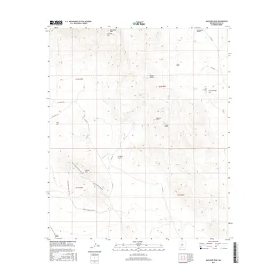
2017 Map of Massacre Peak
USGS Topo · Published 2017About this map
Massacre Peak and the southern extent of the Cookes Range dominate this desert landscape, revealing a history shaped by reliable water sources and westward migration. The presence of Cookes Spring and Fort Cummings Cem marks the site of an essential stop for travelers, where the Butterfield Trl once provided a vital overland stage route through this arid terrain. The map highlights the intersection of frontier history and modern recreation, showing the original trail corridor alongside the Hidden Valley Rd and specialized paths like the Fluorite Ridge: Mine Shaft Segment. Natural landmarks with evocative names such as Starvation Draw, Fryingpan Canyon, and Rattlesnake Ridge reflect the harsh environment faced by early settlers. The complex topography around Fluorite Ridge includes an extensive trail system featuring the Fluorite Ridge: Outer Loop Trail, illustrating how these once-remote heights are now navigated for exploration.
Find a feature on this map
29 named features on this map. Tap any name to fly to it.
Don’t see what you’re looking for? This feature index may not catch every label — zoom into the map to look around manually.
Map Details
Editions of this 2017 Massacre Peak Map
This is the sole edition of this map. No revisions or reprints were ever made.
Other maps of this area

1899 · Deming
USGS Topo · 1:125,000

1915 · Deming
USGS Topo · 1:125,000

1955 · Las Cruces
USGS Topo · 1:250,000

1956 · Dwyer
USGS Topo · 1:62,500

1958 · Las Cruces
USGS Topo · 1:250,000

1962 · Lake Valley
USGS Topo · 1:62,500

1964 · Goat Ridge
USGS Topo · 1:24,000

1964 · Florida
USGS Topo · 1:24,000

1964 · Deming West
USGS Topo · 1:24,000

1964 · Massacre Peak
USGS Topo · 1:24,000