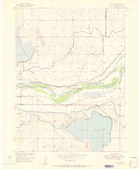
1951 Map of Masters
USGS Topo · Published 1951About this map
South Platte River waters dominate this agricultural landscape along the border of Weld and Morgan counties, where a complex irrigation system was well-established by the early 1950s. The network of the Riverside Canal, Empire Canal, and Bijou Canal moves water across the arid plains to support local farming, anchored by large water bodies like Empire Reservoir and Riverside Reservoir. The Union Pacific railroad corridor provides the primary transit spine, connecting the small settlements of Masters and Sublette along the river valley.
Find a feature on this map
18 named features on this map. Tap any name to fly to it.
Don’t see what you’re looking for? This feature index may not catch every label — zoom into the map to look around manually.
Map Details
Editions of this 1951 Masters Map
2 editions found
Other maps of this area

1950 · Wiggins
USGS Topo · 1:24,000

1950 · Greasewood Lake
USGS Topo · 1:24,000

1950 · Masters
USGS Topo · 1:24,000

1951 · Masters
USGS Topo · 1:24,000

1951 · Orchard
USGS Topo · 1:24,000

1951 · Roggen
USGS Topo · 1:24,000

1951 · Sunken Lake
USGS Topo · 1:24,000

1951 · Omar
USGS Topo · 1:24,000

1951 · Point Of Rocks
USGS Topo · 1:24,000
1951 · Dearfield
USGS Topo · 1:24,000