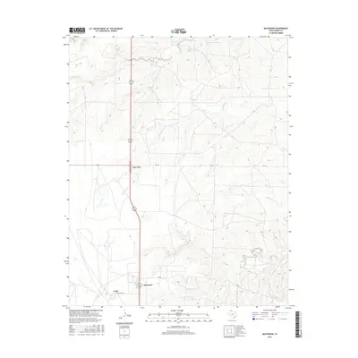
2016 Map of Masterson
USGS Topo · Published 2016About this map
Masterson and the surrounding Moore County landscape are defined by a network of ephemeral drainages and industrial infrastructure in the mid-2010s. The settlement of Exell sits at the southern edge of the sheet, where Helium Plant Rd hints at the region's historical role in the helium industry. To the north, the junction at Four Way marks a central transit point between wide-reaching ranch lands and local corridors like FM 1913. The terrain is etched by numerous seasonal watercourses, including the winding paths of Little Blue Creek, Grapevine Cr, and South Plum Creek. These natural features, alongside smaller branches like Running Water Cr and Sand Cr, provide a clear picture of the High Plains topography and the scattered rural roads that connect these isolated Texas Panhandle communities.
Find a feature on this map
14 named features on this map. Tap any name to fly to it.
Don’t see what you’re looking for? This feature index may not catch every label — zoom into the map to look around manually.
Map Details
Editions of this 2016 Masterson Map
This is the sole edition of this map. No revisions or reprints were ever made.
Other maps of this area

1936 · Fourways
USGS Topo · 1:62,500

1953 · Marsh
USGS Topo · 1:24,000

1953 · Masterson
USGS Topo · 1:24,000

1953 · McDowell Creek
USGS Topo · 1:24,000

1953 · Spencer Draw
USGS Topo · 1:24,000

1954 · Tucumcari
USGS Topo · 1:250,000

1954 · Amarillo
USGS Topo · 1:250,000

1958 · Amarillo
USGS Topo · 1:250,000

1958 · Tucumcari
USGS Topo · 1:250,000

1963 · Stallwitz Lake
USGS Topo · 1:24,000