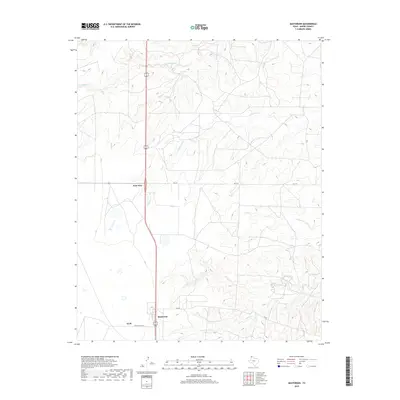
2019 Map of Masterson
USGS Topo · Published 2019About this map
Masterson and the nearby junction at Four Way anchor this Moore County landscape, reflecting the modern infrastructure and industrial heritage of the Texas Panhandle. The presence of Helium Plant Rd near the settlement of Exell alludes to the region's significant role in helium production, a critical local industry. The terrain is defined by a dense network of intermittent drainage systems, where Little Blue Creek and Sand Cr cut through the high plains toward the north, while Plum Creek and its branches, N Plum Cr and S Plum Cr, carve the topography to the southeast. These creek beds and various draws, such as Grapevine Cr, illustrate the complex erosion patterns typical of the Canadian River watershed area. Transportation is dominated by north-south corridors and rural routes like FM 1913 and Cig Rd, which connect these isolated settlements and industrial sites.
Find a feature on this map
15 named features on this map. Tap any name to fly to it.
Don’t see what you’re looking for? This feature index may not catch every label — zoom into the map to look around manually.
Map Details
Editions of this 2019 Masterson Map
This is the sole edition of this map. No revisions or reprints were ever made.
Other maps of this area

1936 · Fourways
USGS Topo · 1:62,500

1953 · Marsh
USGS Topo · 1:24,000

1953 · Masterson
USGS Topo · 1:24,000

1953 · McDowell Creek
USGS Topo · 1:24,000

1953 · Spencer Draw
USGS Topo · 1:24,000

1954 · Tucumcari
USGS Topo · 1:250,000

1954 · Amarillo
USGS Topo · 1:250,000

1958 · Amarillo
USGS Topo · 1:250,000

1958 · Tucumcari
USGS Topo · 1:250,000

1963 · Stallwitz Lake
USGS Topo · 1:24,000