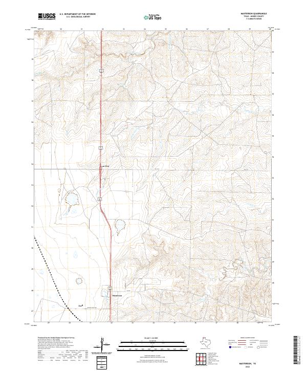
2022 Map of Masterson
USGS Topo · Published 2022About this map
The settlement of Masterson sits at the junction of critical local corridors in this portion of Moore County. The landscape is defined by the dissection of the High Plains by numerous drainage systems, including Little Blue Creek, Sand Cr, and Grapevine Cr, which flow generally eastward toward the Canadian River basin. These creek beds create significant relief against the otherwise flat plateau, revealing the complex erosion patterns characteristic of the Texas Panhandle. At the crossroads of highway 87 and FM 1913 lies Four Way, a notable landmark for regional travel and navigation.
Find a feature on this map
13 named features on this map. Tap any name to fly to it.
Don’t see what you’re looking for? This feature index may not catch every label — zoom into the map to look around manually.
Map Details
Editions of this 2022 Masterson Map
This is the sole edition of this map. No revisions or reprints were ever made.
Other maps of this area

1936 · Fourways
USGS Topo · 1:62,500

1953 · Marsh
USGS Topo · 1:24,000

1953 · Masterson
USGS Topo · 1:24,000

1953 · McDowell Creek
USGS Topo · 1:24,000

1953 · Spencer Draw
USGS Topo · 1:24,000

1954 · Tucumcari
USGS Topo · 1:250,000

1954 · Amarillo
USGS Topo · 1:250,000

1958 · Amarillo
USGS Topo · 1:250,000

1958 · Tucumcari
USGS Topo · 1:250,000

1963 · Stallwitz Lake
USGS Topo · 1:24,000