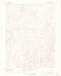
1967 Map of Matchless Mountain
USGS Topo · Published 1971About this map
Matchless Mountain and the high peaks of the Gunnison National Forest dominate this late-1960s terrain. The landscape is defined by its verticality, with steep drainages such as Wheelbarrow Gulch and Dustin Gulch carving through the granite toward the Taylor Canyon floor. Evidence of the region’s resource extraction history is visible at the Doctor Mine and several other unlabeled shafts and prospects scattered across Doctor Gulch and Kirby Gulch.
Find a feature on this map
39 named features on this map. Tap any name to fly to it.
Don’t see what you’re looking for? This feature index may not catch every label — zoom into the map to look around manually.
Map Details
Editions of this 1967 Matchless Mountain Map
4 editions found
Other maps of this area

1888 · Crested Butte
USGS Topo · 1:62,500

1889 · Crested Butte
USGS Topo · 1:62,500

1893 · Crested Butte
USGS Topo · 1:62,500

1934 · Taylor Park
USGS Topo · 1:62,500

1937 · Taylor Park
USGS Topo · 1:62,500

1941 · Pitkin
USGS Topo · 1:62,500

1945 · Pitkin
USGS Topo · 1:62,500

1956 · Montrose
USGS Topo · 1:250,000

1959 · Montrose
USGS Topo · 1:250,000

1960 · Montrose
USGS Topo · 1:250,000