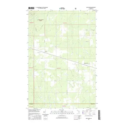
2017 Map of Matchwood
USGS Topo · Published 2017About this map
The Ottawa National Forest blankets much of this Upper Peninsula landscape, where the settlements of Matchwood and Topaz serve as the primary hubs of human activity. The area is defined by its drainage network, with the W Br Ontonagon River cutting through the northwest corner and numerous tributaries like Tenmile Cr and Mill Cr flowing through the timberlands. Local infrastructure is closely tied to the historic transit corridor of Old M 28, which runs parallel to the aptly named Railroad St in Matchwood. This map illustrates the intersection of industrial forest management and small-town Michigan life, with numerous Forest Service tracks such as Nfst-530 and Nfst-622 branching out into the woods. The southern boundary marks the transition from Ontonagon to Gogebic County, emphasizing the remote character of these township lands.
Find a feature on this map
40 named features on this map. Tap any name to fly to it.
Don’t see what you’re looking for? This feature index may not catch every label — zoom into the map to look around manually.
Map Details
Editions of this 2017 Matchwood Map
This is the sole edition of this map. No revisions or reprints were ever made.
Other maps of this area

1949 · Matchwood NW
USGS Topo · 1:24,000

1949 · Bergland NE
USGS Topo · 1:24,000

1952 · Thayer
USGS Topo · 1:62,500

1955 · Marenisco
USGS Topo · 1:62,500

1956 · Bergland NE
USGS Topo · 1:24,000

1956 · Bergland
USGS Topo · 1:62,500

1956 · Matchwood NW
USGS Topo · 1:24,000

1956 · Matchwood
USGS Topo · 1:62,500

1958 · Iron River
USGS Topo · 1:250,000

1960 · Iron River
USGS Topo · 1:250,000