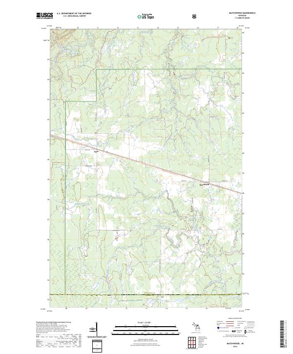
2023 Map of Matchwood
USGS Topo · Published 2023About this map
Ottawa National Forest dominates this landscape in Ontonagon County, where timber and transit have long shaped the local character. The small settlements of Matchwood and Topaz sit along the corridor of Old M 28, a route paralleled by the Bergland-to-Sidnaw State Trl, suggesting a legacy of rail and road commerce through the north woods. The terrain is defined by a dense network of drainage, with the West Branch Ontonagon River cutting across the northwest and numerous smaller waterways like Tenmile Creek and Bebo Creek flowing through the forest. Further evidence of local navigation and land use is visible in the network of forest roads and trails, including Norwich Rd and the high-elevation Matchwood Tower Rd, providing access to the more remote reaches of the upper peninsula wilderness.
Find a feature on this map
45 named features on this map. Tap any name to fly to it.
Don’t see what you’re looking for? This feature index may not catch every label — zoom into the map to look around manually.
Map Details
Editions of this 2023 Matchwood Map
This is the sole edition of this map. No revisions or reprints were ever made.
Other maps of this area

1949 · Matchwood NW
USGS Topo · 1:24,000

1949 · Bergland NE
USGS Topo · 1:24,000

1952 · Thayer
USGS Topo · 1:62,500

1955 · Marenisco
USGS Topo · 1:62,500

1956 · Bergland NE
USGS Topo · 1:24,000

1956 · Bergland
USGS Topo · 1:62,500

1956 · Matchwood NW
USGS Topo · 1:24,000

1956 · Matchwood
USGS Topo · 1:62,500

1958 · Iron River
USGS Topo · 1:250,000

1960 · Iron River
USGS Topo · 1:250,000