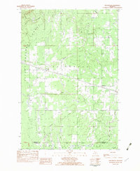
1982 Map of Matchwood
USGS Topo · Published 1983About this map
Ottawa National Forest dominates this section of the Upper Peninsula, where timberlands and waterways define the geography near the border of Ontonagon and Gogebic Counties. The small settlements of Matchwood and Topaz serve as the primary human hubs, both situated along the vital Soo Line railroad corridor. This rail line provided the essential connection for transporting forest products out of the region during the late 20th century. The landscape is heavily dissected by a dense network of water, including the West Branch Ontonagon River in the northwest and numerous drainage systems such as Matchwood Creek, Tenmile Creek, and Wanagon Creek. A prominent gas pipeline cuts across the center of the township, illustrating the infrastructure requirements of this remote northern landscape as it appeared in the early 1980s.
Find a feature on this map
17 named features on this map. Tap any name to fly to it.
Don’t see what you’re looking for? This feature index may not catch every label — zoom into the map to look around manually.
Map Details
Editions of this 1982 Matchwood Map
This is the sole edition of this map. No revisions or reprints were ever made.
Other maps of this area

1949 · Matchwood NW
USGS Topo · 1:24,000

1949 · Bergland NE
USGS Topo · 1:24,000

1952 · Thayer
USGS Topo · 1:62,500

1955 · Marenisco
USGS Topo · 1:62,500

1956 · Bergland NE
USGS Topo · 1:24,000

1956 · Bergland
USGS Topo · 1:62,500

1956 · Matchwood NW
USGS Topo · 1:24,000

1956 · Matchwood
USGS Topo · 1:62,500

1958 · Iron River
USGS Topo · 1:250,000

1960 · Iron River
USGS Topo · 1:250,000