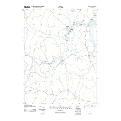
2010 Map of Mather
USGS Topo · Published 2010About this map
Monongahela River coal production and small industrial settlements dominate this 2010 study of the region surrounding Mather. The landscape is a network of mining legacies, evidenced by the large Emerald Mine and distinct entry points like the Clyde 3 Portal and Edwards Shaft Portal. Residential patterns reflect historical company housing and expansion, from the clustered Teagarden Homes and Braden Plan near Clarksville to the uniquely named Pitt Gas and Black Dog Hollow. The terrain is carved by Tenmile Creek and its south fork, which wind through numerous small communities including Jefferson and Dry Tavern. Genealogists will find several family and community burial grounds well-documented, such as Mount Zion Cemetery and Pollock Cemetery, alongside recreational features like Greene County Memorial Park and Rohannas Golf Course.
Find a feature on this map
114 named features on this map. Tap any name to fly to it.
Don’t see what you’re looking for? This feature index may not catch every label — zoom into the map to look around manually.
Map Details
Editions of this 2010 Mather Map
This is the sole edition of this map. No revisions or reprints were ever made.
Other maps of this area

1900 · Masontown
USGS Topo · 1:62,500

1901 · Amity
USGS Topo · 1:62,500

1901 · Waynesburg
USGS Topo · 1:62,500

1902 · Brownsville
USGS Topo · 1:62,500

1903 · Masontown
USGS Topo · 1:62,500

1904 · Amity
USGS Topo · 1:62,500

1904 · Waynesburg
USGS Topo · 1:62,500

1906 · Brownsville
USGS Topo · 1:62,500

1931 · Brownsville
USGS Topo · 1:62,500

1931 · Masontown
USGS Topo · 1:62,500