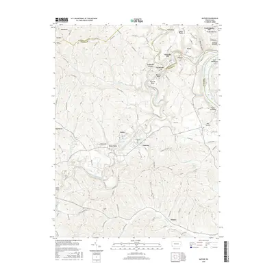
2016 Map of Mather
USGS Topo · Published 2016About this map
Tenmile Creek and its many branches, including the South Fork Tenmile Creek, dictate the layout of this section of Southwestern Pennsylvania. The map illustrates a landscape of established coal-patch towns and rural residential plans, such as Pitt Gas, Teagarden Homes, and Burson Plan, which are concentrated around the industrial and mining centers of Clarksville and Mather. The Monongahela River forms a critical eastern boundary, with riverfront settlements like Millsboro and Rices Landing representing the region's long history of river-based commerce. Away from the water, the terrain is marked by smaller family and community landmarks, from Zion Cem in the northwest to the Greene County Airport in the southwest. Cultural sites like Greene County Memorial Park and the Wayne Tunnel further distinguish the geography of this Greene and Washington County borderland.
Find a feature on this map
104 named features on this map. Tap any name to fly to it.
Don’t see what you’re looking for? This feature index may not catch every label — zoom into the map to look around manually.
Map Details
Editions of this 2016 Mather Map
This is the sole edition of this map. No revisions or reprints were ever made.
Other maps of this area

1900 · Masontown
USGS Topo · 1:62,500

1901 · Amity
USGS Topo · 1:62,500

1901 · Waynesburg
USGS Topo · 1:62,500

1902 · Brownsville
USGS Topo · 1:62,500

1903 · Masontown
USGS Topo · 1:62,500

1904 · Amity
USGS Topo · 1:62,500

1904 · Waynesburg
USGS Topo · 1:62,500

1906 · Brownsville
USGS Topo · 1:62,500

1931 · Brownsville
USGS Topo · 1:62,500

1931 · Masontown
USGS Topo · 1:62,500