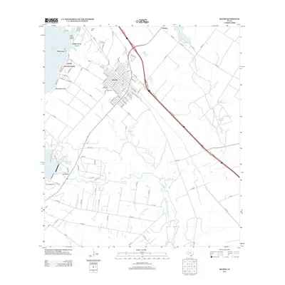
2013 Map of Mathis
USGS Topo · Published 2013About this map
Mathis serves as the regional hub in this 2013 topographic survey, situated at the intersection of significant transit corridors and the sprawling waters of Lake Corpus Christi. The town's grid is flanked by residential developments like Lakewood Heights and Clearwater Cove that overlook the lake's eastern shore. Local history is anchored by several burial grounds, including Mathis Cem, the Descanso Eterno Cem, and the more rural Cenzo Hill Cem to the north. South of the city, the Nueces River winds through the coastal plain, passing the community of La Fruta and the Shawondasse Camp. The landscape transitions from these riparian zones to agricultural and industrial sites like Vahlsing in the northeast, connected by a network of farm-to-market roads and the modern Interstate 37 corridor.
Find a feature on this map
106 named features on this map. Tap any name to fly to it.
Don’t see what you’re looking for? This feature index may not catch every label — zoom into the map to look around manually.
Map Details
Editions of this 2013 Mathis Map
This is the sole edition of this map. No revisions or reprints were ever made.
Other maps of this area

1925 · Mathis No. 2
USGS Topo · 1:48,000

1925 · Robstown
USGS Topo · 1:62,500

1925 · Mathis No. 3
USGS Topo · 1:48,000

1927 · Mathis
USGS Topo · 1:62,500

1950 · Corpus Christi
USGS Topo · 1:250,000

1953 · Beeville
USGS Topo · 1:250,000

1954 · Orange Grove
USGS Topo · 1:62,500

1954 · Robstown
USGS Topo · 1:62,500

1954 · Mathis
USGS Topo · 1:62,500

1954 · Sinton
USGS Topo · 1:62,500