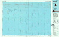
1994 Map of Matinicus
USGS Topo · Published 1994About this map
Matinicus Isle Plt represents one of the most remote outposts on the Maine coast, centered around the isolated settlements of Matinicus and Criehaven. This 1994 edition, based on earlier 1970s surveys and 1992 aerial photography, details the complex archipelago of the outer Penobscot Bay. The map illustrates a landscape defined by rocky points and vital navigational landmarks, such as Matinicus Rock and Wilson Head.
Find a feature on this map
32 named features on this map. Tap any name to fly to it.
Don’t see what you’re looking for? This feature index may not catch every label — zoom into the map to look around manually.
Map Details
Editions of this 1994 Matinicus Map
This is the sole edition of this map. No revisions or reprints were ever made.
Other maps of this area

1904 · Deer Isle
USGS Topo · 1:62,500

1904 · Swan Island
USGS Topo · 1:62,500

1904 · Vinalhaven
USGS Topo · 1:62,500

1904 · Tenants Harbor
USGS Topo · 1:62,500

1904 · Rockland
USGS Topo · 1:62,500

1905 · Penobscot Bay
USGS Topo · 1:125,000

1906 · Matinicus
USGS Topo · 1:62,500

1906 · Tennant Harbor
USGS Topo · 1:62,500

1906 · Rockland
USGS Topo · 1:62,500

1941 · Rockland
USGS Topo · 1:62,500
Featured Places
- Vinalhaven, ME
- Matinicus Isle Plantation, ME
- Matinicus Isle, Matinicus Isle Plantation
- Isle au Haut, ME
- Criehaven Township, ME