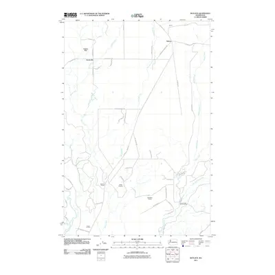
2011 Map of Matlock
USGS Topo · Published 2011About this map
Turnow Cemetery lies near the southern reaches of this Mason County landscape, situated between the Middle Fork Satsop River and the meandering path of Decker Creek. The area is characterized by open clearings like Scott Prairie and Carstairs Prairie, which break up the wooded terrain between the settlements of Deckerville and Matlock. To the north, the rail-inflected name Frisken Wye sits near the junction of W Frisken Y Rd and Boundary Rd, reflecting the region's historic transportation patterns. The Simpson State Salmon Hatchery is a prominent local fixture situated along the Bingham Creek drainage, just north of where it meets the East Fork Satsop River. This map details a network of rural routes including W Mary M Knight Rd and Matlock-Deckerville Rd, which connect the scattered homesteads and small communities of this river-cut timberland.
Find a feature on this map
48 named features on this map. Tap any name to fly to it.
Don’t see what you’re looking for? This feature index may not catch every label — zoom into the map to look around manually.
Map Details
Editions of this 2011 Matlock Map
This is the sole edition of this map. No revisions or reprints were ever made.
Other maps of this area

1921 · Satsop
USGS Topo · 1:62,500

1941 · Mobray
USGS Topo · 1:62,500

1943 · Nahwatzel Lake
USGS Topo · 1:62,500

1943 · Mobray
USGS Topo · 1:62,500

1953 · Mt Tebo
USGS Topo · 1:62,500

1953 · Elma
USGS Topo · 1:62,500

1955 · Wynoochee Valley
USGS Topo · 1:62,500

1955 · Grisdale
USGS Topo · 1:62,500

1958 · Seattle
USGS Topo · 1:250,000

1962 · Seattle
USGS Topo · 1:250,000