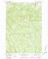
1969 Map of Matlock Prairie
USGS Topo · Published 1984About this map
Umatilla National Forest defines this high-elevation landscape on the border of Morrow and Umatilla Counties. The area is characterized by high meadows and volcanic peaks, notably Arbuckle Mtn and Matlock Hill. A network of pack trails, including the Freezeout (Pack) Trail and North Jones (Pack) Trail, crisscrosses the terrain, linking remote high-country sites like Fivemile Cow Camp and the Ellis Forest Service Sta.
Find a feature on this map
41 named features on this map. Tap any name to fly to it.
Don’t see what you’re looking for? This feature index may not catch every label — zoom into the map to look around manually.
Map Details
Editions of this 1969 Matlock Prairie Map
2 editions found
Other maps of this area

1953 · Pendleton
USGS Topo · 1:250,000

1956 · Pendleton
USGS Topo · 1:250,000

1967 · Freezeout Ridge
USGS Topo · 1:24,000

1968 · Hoodlum Canyon
USGS Topo · 1:24,000

1968 · Gurdane
USGS Topo · 1:24,000

1969 · Lake Penland
USGS Topo · 1:24,000

1969 · Sugarbowl Creek
USGS Topo · 1:24,000

1969 · Deerhorn Creek
USGS Topo · 1:24,000

1969 · Thompson Flat
USGS Topo · 1:24,000

1969 · Arbuckle Mtn
USGS Topo · 1:24,000