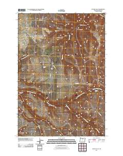
2011 Map of Matney Flat
USGS Topo · Published 2011About this map
Matney Flat and the surrounding high country of Gilliam County are defined by a network of deep drainage systems and ranching history. The landscape is carved by several major waterways, including the East Fork Thirtymile Creek and Lost Valley Creek, which create significant topographical relief through named features like Monahan Canyon and Stackhouse Canyon. Human presence is anchored by the Summers Ranch and the isolated Papersack Cemetery located in the southern portion of the quadrangle.
Find a feature on this map
22 named features on this map. Tap any name to fly to it.
Don’t see what you’re looking for? This feature index may not catch every label — zoom into the map to look around manually.
Map Details
Editions of this 2011 Matney Flat Map
This is the sole edition of this map. No revisions or reprints were ever made.
Other maps of this area

1916 · Condon
USGS Topo · 1:125,000

1953 · Pendleton
USGS Topo · 1:250,000

1953 · The Dalles
USGS Topo · 1:250,000

1956 · The Dalles
USGS Topo · 1:250,000

1956 · Pendleton
USGS Topo · 1:250,000

1957 · The Dalles
USGS Topo · 1:250,000

1968 · Gooseberry
USGS Topo · 1:24,000
1969 · Lonerock
USGS Topo · 1:24,000

1970 · Condon
USGS Topo · 1:24,000
1970 · Salmon Fork
USGS Topo · 1:24,000