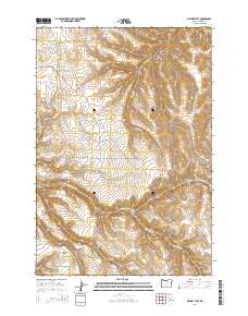
2014 Map of Matney Flat
USGS Topo · Published 2014About this map
Matney Flat and the surrounding high country of Gilliam County are defined by a complex network of seasonal drainages and named ridges. The geography is dominated by deep incisions such as Sixmile Canyon and Stackhouse Canyon, which feed into larger systems like the E Fork Thirtymile Cr and Rock Cr. This landscape reflects the ranching and agricultural patterns of eastern Oregon, where movement is dictated by the canyons and ridges. Local history is anchored at the Papersack Cem, situated near Papersack Canyon. Notable landmarks like Black Butte and Pine Ridge provide significant orientation points across the high plateaus. The road network, including Or-206 and Lonerock Rd, follows the natural contours of the land, connecting disparate canyons like Springston Canyon and Graham Canyon.
Find a feature on this map
30 named features on this map. Tap any name to fly to it.
Don’t see what you’re looking for? This feature index may not catch every label — zoom into the map to look around manually.
Map Details
Editions of this 2014 Matney Flat Map
This is the sole edition of this map. No revisions or reprints were ever made.
Other maps of this area

1916 · Condon
USGS Topo · 1:125,000

1953 · Pendleton
USGS Topo · 1:250,000

1953 · The Dalles
USGS Topo · 1:250,000

1956 · The Dalles
USGS Topo · 1:250,000

1956 · Pendleton
USGS Topo · 1:250,000

1957 · The Dalles
USGS Topo · 1:250,000

1968 · Gooseberry
USGS Topo · 1:24,000
1969 · Lonerock
USGS Topo · 1:24,000

1970 · Condon
USGS Topo · 1:24,000
1970 · Salmon Fork
USGS Topo · 1:24,000