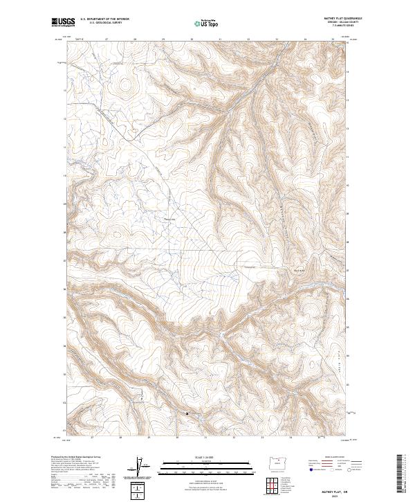
2023 Map of Matney Flat
USGS Topo · Published 2023About this map
Matney Flat occupies a central position in this corner of Gilliam County, characterized by a complex network of canyons and ridges typical of the Columbia Plateau. The landscape is deeply incised by drainages such as Monahan Canyon and Papersack Canyon, where the Papersack Cem provides a point of significant genealogical interest. To the west, the Old Railroad Grade follows the contour above Dry Fork Thirtymile Creek, preserving a trace of earlier transportation infrastructure through the region.
Find a feature on this map
30 named features on this map. Tap any name to fly to it.
Don’t see what you’re looking for? This feature index may not catch every label — zoom into the map to look around manually.
Map Details
Editions of this 2023 Matney Flat Map
This is the sole edition of this map. No revisions or reprints were ever made.
Other maps of this area

1916 · Condon
USGS Topo · 1:125,000

1953 · Pendleton
USGS Topo · 1:250,000

1953 · The Dalles
USGS Topo · 1:250,000

1956 · The Dalles
USGS Topo · 1:250,000

1956 · Pendleton
USGS Topo · 1:250,000

1957 · The Dalles
USGS Topo · 1:250,000

1968 · Gooseberry
USGS Topo · 1:24,000
1969 · Lonerock
USGS Topo · 1:24,000

1970 · Condon
USGS Topo · 1:24,000
1970 · Salmon Fork
USGS Topo · 1:24,000