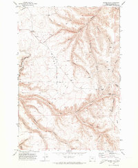
1970 Map of Matney Flat
USGS Topo · Published 1973About this map
The high plateau of Matney Flat dominates this 1970s survey of Gilliam County, characterized by a series of deep canyons that drain toward the East Fork Thirty-mile Creek. The landscape reflects a remote agricultural and transport infrastructure, featuring the Kinzua and Southern RR winding through the western canyons. Evidence of local life and early travel is scattered throughout the breaks, including the Condon Trail and several springs that likely served as critical water points for livestock and travelers alike.
Find a feature on this map
29 named features on this map. Tap any name to fly to it.
Don’t see what you’re looking for? This feature index may not catch every label — zoom into the map to look around manually.
Map Details
Editions of this 1970 Matney Flat Map
This is the sole edition of this map. No revisions or reprints were ever made.
Other maps of this area

1916 · Condon
USGS Topo · 1:125,000

1953 · Pendleton
USGS Topo · 1:250,000

1953 · The Dalles
USGS Topo · 1:250,000

1956 · The Dalles
USGS Topo · 1:250,000

1956 · Pendleton
USGS Topo · 1:250,000

1957 · The Dalles
USGS Topo · 1:250,000

1968 · Gooseberry
USGS Topo · 1:24,000
1969 · Lonerock
USGS Topo · 1:24,000

1970 · Condon
USGS Topo · 1:24,000
1970 · Salmon Fork
USGS Topo · 1:24,000