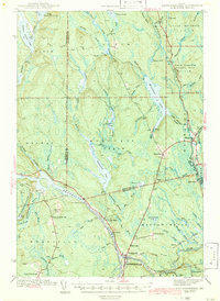
1942 Map of Mattawamkeag
USGS Topo · Published 1942About this map
Mattawamkeag serves as a vital rail junction on this 1942 survey, where the Maine Central Railroad meets the Canadian Pacific Railroad along the banks of the Penobscot River. The landscape is a complex network of timberlands and waterways, including the large Molunkus Lake and several significant bogs like Martin Bog and Carlton Bog. Industrial and agricultural footprints are visible at the Mattaseunk Dam and smaller settlements such as Jordan Mills and Macwahoc.
Find a feature on this map
77 named features on this map. Tap any name to fly to it.
Don’t see what you’re looking for? This feature index may not catch every label — zoom into the map to look around manually.
Map Details
Editions of this 1942 Mattawamkeag Map
3 editions found
Other maps of this area

1920 · Winn
USGS Topo · 1:62,500

1931 · Springfield
USGS Topo · 1:48,000

1934 · Springfield
USGS Topo · 1:62,500

1940 · Sherman
USGS Topo · 1:62,500

1940 · Mattawamkeag
USGS Topo · 1:62,500

1941 · Mattawamkeag Lake
USGS Topo · 1:62,500

1941 · Wytopitlock
USGS Topo · 1:62,500

1942 · Lincoln
USGS Topo · 1:62,500

1942 · Mattawamkeag
USGS Topo · 1:62,500

1942 · Sherman
USGS Topo · 1:62,500