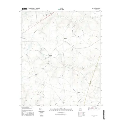
2017 Map of Matthews
USGS Topo · Published 2017About this map
Stellaville and the central village of Matthews anchor this portion of the Georgia coastal plain near the boundary of Jefferson and Burke counties. The landscape is a network of small family settlements and rural crossroads, characterized by an exceptionally high density of historic burial grounds such as Beasley Cem, Mount Moriah Cem, and the Mosley Chapel Cem near the southern edge. The agrarian roots of the region are evidenced by water-management features like Nortons Millrace on the northern border and named crossings like Ways Bridge. Small local drainage systems, including Brushy Cr and Bull Nose Br, carve through the terrain, while landmarks such as Ways Grove Cem and Smiths Grove Cem mark long-standing community centers along the winding local road network.
Find a feature on this map
81 named features on this map. Tap any name to fly to it.
Don’t see what you’re looking for? This feature index may not catch every label — zoom into the map to look around manually.
Map Details
Editions of this 2017 Matthews Map
This is the sole edition of this map. No revisions or reprints were ever made.
Other maps of this area

1919 · Gough
USGS Topo · 1:62,500

1920 · Stapleton
USGS Topo · 1:62,500

1922 · Harlem
USGS Topo · 1:62,500

1922 · Hephzibah
USGS Topo · 1:62,500

1948 · Hephzibah
USGS Topo · 1:62,500

1948 · Harlem
USGS Topo · 1:62,500

1948 · Stapleton
USGS Topo · 1:62,500

1948 · Gough
USGS Topo · 1:62,500

1948 · Blythe
USGS Topo · 1:24,000

1948 · Louisville
USGS Topo · 1:24,000