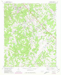
1971 Map of Matthews
USGS Topo · Published 1981About this map
Matthews and the surrounding rural communities of Mecklenburg and Union counties are documented here during a period of transition as Charlotte's suburban influence began to expand. The Seaboard Coast Line corridor serves as the primary axis for development, connecting the established town centers of Stallings, Indian Trail, and Stouts. This alignment of transportation and settlement patterns follows the gentle divide between the drainage of Fourmile Creek and the headwaters of the North Fork and South Fork Crooked Creeks.
Find a feature on this map
39 named features on this map. Tap any name to fly to it.
Don’t see what you’re looking for? This feature index may not catch every label — zoom into the map to look around manually.
Map Details
Editions of this 1971 Matthews Map
3 editions found
Other maps of this area

1905 · Charlotte
USGS Topo · 1:48,000

1907 · Charlotte
USGS Topo · 1:62,500

1941 · Charlotte
USGS Topo · 1:125,000

1941 · Spartanburg
USGS Topo · 1:250,000

1942 · Charlotte
USGS Topo · 1:125,000

1948 · Charlotte East
USGS Topo · 1:24,000

1949 · Charlotte East
USGS Topo · 1:24,000

1949 · Wilgrove
USGS Topo · 1:24,000

1949 · Midland
USGS Topo · 1:24,000

1953 · Spartanburg
USGS Topo · 1:250,000