1937 Map of Mattoon
USGS Topo · Published 1951About this map
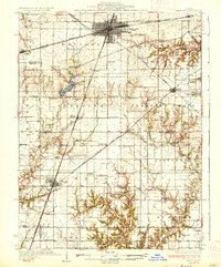
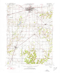
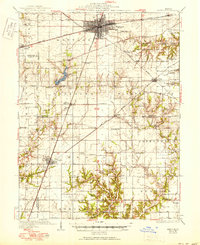
Mattoon serves as the central hub of this East Central Illinois landscape, where the New York Central and Illinois Central railroads intersect. The map illustrates a densely settled agricultural region defined by its numerous rural schools, such as Mound Sch and Dry Grove Sch, and the presence of the State Fish Hatchery near Lake Mattoon. Southward, the terrain becomes more dissected near the Little Wabash River and Muddy Creek. Small communities like Lerna, Trilla, and Neoga are connected by a web of rail lines and early state routes. The abundance of named cemeteries, including Wright Cem and Drummond Cem, alongside rural churches like Shiloh Ch, provides significant detail for researchers tracing family history in Coles, Shelby, and Cumberland counties.
Find a feature on this map
88 named features on this map. Tap any name to fly to it.
Don’t see what you’re looking for? This feature index may not catch every label — zoom into the map to look around manually.
Map Details
Editions of this 1937 Mattoon Map
3 editions found