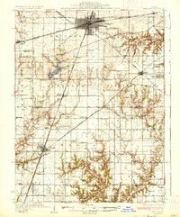
1937 Map of Mattoon
USGS Topo · Published 1937About this map
The city of Mattoon serves as a major railway hub in the late 1930s, defined by the intersection of the New York Central and the Illinois Central lines. To the south, the recently developed Lake Mattoon dominates the landscape, featuring a State Fish Hatchery along its western shore near the headwaters of the Little Wabash River. The surrounding prairie is meticulously subdivided into townships like Paradise and Pleasant Grove, each dotted with a dense network of country schools such as Mound Sch and Dry Grove Sch.
Find a feature on this map
89 named features on this map. Tap any name to fly to it.
Don’t see what you’re looking for? This feature index may not catch every label — zoom into the map to look around manually.
Map Details
Editions of this 1937 Mattoon Map
3 editions found
Other maps of this area

1933 · Toledo
USGS Topo · 1:62,500

1934 · Mattoon
USGS Topo · 1:62,500

1935 · Arcola
USGS Topo · 1:48,000

1935 · Sullivan
USGS Topo · 1:48,000

1936 · Oakland
USGS Topo · 1:48,000

1937 · Mattoon
USGS Topo · 1:62,500

1938 · Toledo
USGS Topo · 1:62,500

1940 · Sullivan
USGS Topo · 1:62,500

1940 · Arcola
USGS Topo · 1:62,500

1940 · Greenup
USGS Topo · 1:62,500