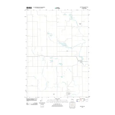
2010 Map of Mattoon
USGS Topo · Published 2010About this map
The village of Mattoon and the unincorporated community of Phlox anchor this Wisconsin landscape, where the local economy and geography are defined by the winding course of the Red River and its various tributaries. Modern aviation footprints are visible at Kitty Hawk Estates Airport and Shelley Airport, showing how the rural terrain near the Langlade and Shawano county lines has integrated private airstrips into its traditional forest and field patterns.
Find a feature on this map
24 named features on this map. Tap any name to fly to it.
Don’t see what you’re looking for? This feature index may not catch every label — zoom into the map to look around manually.
Map Details
Editions of this 2010 Mattoon Map
This is the sole edition of this map. No revisions or reprints were ever made.
Other maps of this area

1952 · Antigo
USGS Topo · 1:48,000

1952 · White Lake
USGS Topo · 1:48,000

1954 · Wittenberg
USGS Topo · 1:48,000

1954 · Gresham
USGS Topo · 1:48,000

1954 · Iron Mountain
USGS Topo · 1:250,000

1955 · Green Bay
USGS Topo · 1:250,000

1959 · Iron Mountain
USGS Topo · 1:250,000

1964 · Wittenberg
USGS Topo · 1:62,500

1964 · Gresham
USGS Topo · 1:62,500
1973 · Antigo
USGS Topo · 1:24,000