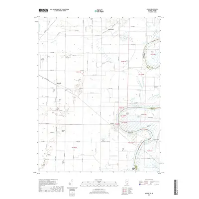
2018 Map of Maunie
USGS Topo · Published 2018About this map
The Wabash River meanders through the landscape of the Illinois-Indiana border, carving out dramatic oxbows and islands like Ribeyre Island. This riverine environment is defined by its complex hydrology, featuring numerous sloughs and ponds such as Upper Sandy Slough, Dick Pond, and Browns Pond. On the Illinois side, the small settlement of Maunie sits near a sharp bend in the river, while Epworth and Garnerville anchor the agricultural interior. The map is a rich resource for genealogists, documenting over a dozen burial sites including the Jones Family Cem, Kuykendall Cem, and Big Prairie Cem. The presence of Aldrich Mound and Thompson Mound indicates long-standing human presence near the river's edge, while Grand Chain Rapids highlights the natural navigation challenges of the Wabash.
Find a feature on this map
57 named features on this map. Tap any name to fly to it.
Don’t see what you’re looking for? This feature index may not catch every label — zoom into the map to look around manually.
Map Details
Editions of this 2018 Maunie Map
This is the sole edition of this map. No revisions or reprints were ever made.
Other maps of this area

1903 · New Harmony
USGS Topo · 1:62,500

1903 · Patoka
USGS Topo · 1:125,000

1905 · New Haven
USGS Topo · 1:62,500

1906 · New Haven
USGS Topo · 1:62,500

1917 · Uniontown
USGS Topo · 1:62,500

1938 · New Harmony
USGS Topo · 1:62,500

1940 · Carmi
USGS Topo · 1:62,500

1943 · Carmi
USGS Topo · 1:62,500

1949 · Paducah
USGS Topo · 1:250,000

1949 · New Haven
USGS Topo · 1:62,500