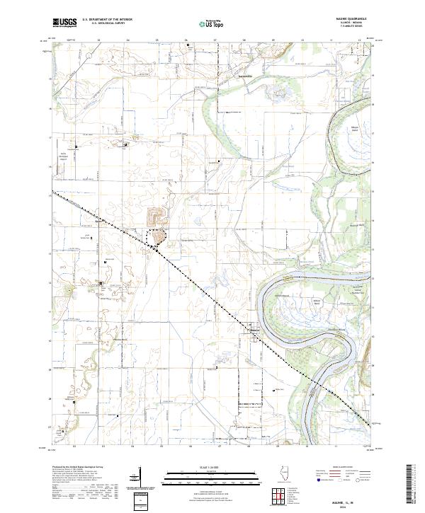
2024 Map of Maunie
USGS Topo · Published 2024About this map
Maunie sits along a dramatic bend in the Wabash River where the Illinois and Indiana border follows the meandering waterway. The landscape is defined by the complex hydrology of the river valley, featuring old oxbow remnants and wetlands like Old Channel Wabash River, The Chute, and Jerry Slough. Evidence of ancient habitation is marked by significant earthworks such as Aldrich Mound and Thompson Mound, which stand out against the agricultural grid of White County.
Find a feature on this map
96 named features on this map. Tap any name to fly to it.
Don’t see what you’re looking for? This feature index may not catch every label — zoom into the map to look around manually.
Map Details
Editions of this 2024 Maunie Map
This is the sole edition of this map. No revisions or reprints were ever made.
Other maps of this area

1903 · New Harmony
USGS Topo · 1:62,500

1903 · Patoka
USGS Topo · 1:125,000

1905 · New Haven
USGS Topo · 1:62,500

1906 · New Haven
USGS Topo · 1:62,500

1917 · Uniontown
USGS Topo · 1:62,500

1938 · New Harmony
USGS Topo · 1:62,500

1940 · Carmi
USGS Topo · 1:62,500

1943 · Carmi
USGS Topo · 1:62,500

1949 · Paducah
USGS Topo · 1:250,000

1949 · New Haven
USGS Topo · 1:62,500