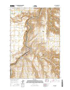
2017 Map of Maupin
USGS Topo · Published 2017About this map
Maupin and its companion settlement East Maupin flank the deep canyon of the Deschutes River in this high-desert landscape of North Central Oregon. The terrain is defined by dramatic elevation changes where the plateau of Juniper Flat drops sharply into river gorges. A prominent natural feature is the confluence where the White River meets the Deschutes, marked by the tiered cascades of White River Falls and Celestial Falls.
Find a feature on this map
43 named features on this map. Tap any name to fly to it.
Don’t see what you’re looking for? This feature index may not catch every label — zoom into the map to look around manually.
Map Details
Editions of this 2017 Maupin Map
This is the sole edition of this map. No revisions or reprints were ever made.
Other maps of this area

1930 · Dufur
USGS Topo · 1:125,000

1934 · Dufur
USGS Topo · 1:125,000

1953 · The Dalles
USGS Topo · 1:250,000

1956 · The Dalles
USGS Topo · 1:250,000

1957 · The Dalles
USGS Topo · 1:250,000

1962 · Sherars Bridge
USGS Topo · 1:24,000

1962 · Postage Stamp Butte
USGS Topo · 1:24,000
1962 · Dant
USGS Topo · 1:24,000

1962 · Sinamox
USGS Topo · 1:24,000
1962 · Tygh Valley
USGS Topo · 1:24,000