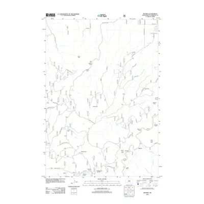
2012 Map of Maurice
USGS Topo · Published 2012About this map
Spearfish Cr cuts through the Black Hills landscape, providing the primary drainage for a region defined by steep gulches and prominent peaks. The small settlement of Maurice is located along the creek's lower reaches, near the notable cascade of Bridal Veil Falls. The terrain is marked by high points like Crow Peak and Little Crow Peak, as well as the distinctive formation of Citadel Rock. Numerous water sources, including Big Spring, Higgins Spring, and Cabin Springs, indicate the importance of reliable water in this mountain environment.
Find a feature on this map
66 named features on this map. Tap any name to fly to it.
Don’t see what you’re looking for? This feature index may not catch every label — zoom into the map to look around manually.
Map Details
Editions of this 2012 Maurice Map
This is the sole edition of this map. No revisions or reprints were ever made.
Other maps of this area

1894 · Deadwood
USGS Topo · 1:125,000

1898 · Sundance
USGS Topo · 1:125,000

1900 · Spearfish
USGS Topo · 1:62,500

1901 · Deadwood
USGS Topo · 1:125,000

1901 · Aladdin
USGS Topo · 1:125,000

1902 · Sundance
USGS Topo · 1:125,000

1903 · Aladdin
USGS Topo · 1:125,000

1907 · Belle Fourche
USGS Topo · 1:125,000

1907 · Redwater
USGS Topo · 1:62,500

1915 · Spearfish
USGS Topo · 1:62,500