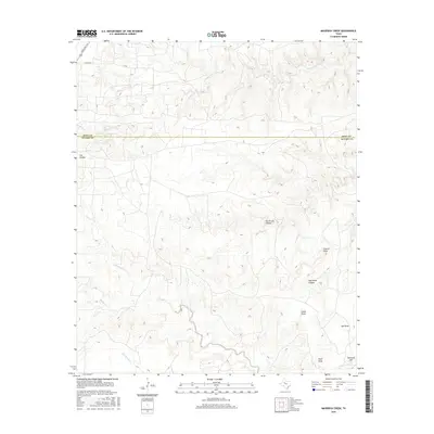
2016 Map of Maverick Creek
USGS Topo · Published 2016About this map
Maverick Creek defines the northern landscape of this West Texas region, winding through a terrain marked by dramatic relief and named draws. The boundary between Kent and Scurry Counties bisects the area, highlighting a transition where ranch roads like Ranch RD 1231 provide access to the high plains. Historically, the names etched into the land—like Church Peak and Overlook Hill—suggest the vantage points used by early inhabitants and cattlemen to navigate the canyon systems.
Find a feature on this map
17 named features on this map. Tap any name to fly to it.
Don’t see what you’re looking for? This feature index may not catch every label — zoom into the map to look around manually.
Map Details
Editions of this 2016 Maverick Creek Map
This is the sole edition of this map. No revisions or reprints were ever made.
Other maps of this area

1932 · Camp Springs
USGS Topo · 1:62,500

1954 · Lloyd Mountain
USGS Topo · 1:24,000

1954 · Brand
USGS Topo · 1:24,000

1954 · Lubbock
USGS Topo · 1:250,000

1954 · Big Spring
USGS Topo · 1:250,000

1958 · Big Spring
USGS Topo · 1:250,000

1969 · Camp Springs
USGS Topo · 1:24,000

1969 · Maverick Creek
USGS Topo · 1:24,000
1969 · Hudd
USGS Topo · 1:24,000

1969 · Cooper Mountain
USGS Topo · 1:24,000