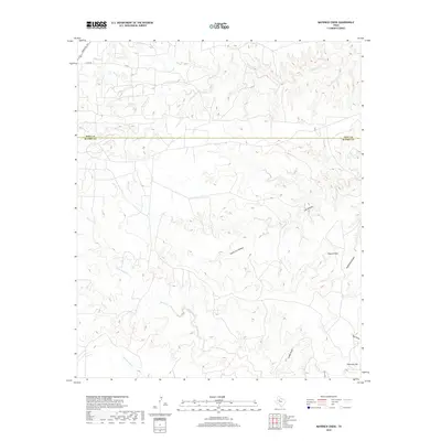
2019 Map of Maverick Creek
USGS Topo · Published 2019About this map
Church Peak stands as a prominent topographical landmark in this section of West Texas, where the border between Kent and Scurry counties divides the landscape. This 2019 survey documents a terrain defined by complex drainage systems and erosion patterns, most notably the meandering course of Maverick Cr in the north and the expansive Rough Creek system to the south. The area is etched with deep incisions such as South Cox Hollow and Redaleck Canyon, illustrating the persistent hydrological forces at work in this arid environment.
Find a feature on this map
17 named features on this map. Tap any name to fly to it.
Don’t see what you’re looking for? This feature index may not catch every label — zoom into the map to look around manually.
Map Details
Editions of this 2019 Maverick Creek Map
This is the sole edition of this map. No revisions or reprints were ever made.
Other maps of this area

1932 · Camp Springs
USGS Topo · 1:62,500

1954 · Lloyd Mountain
USGS Topo · 1:24,000

1954 · Brand
USGS Topo · 1:24,000

1954 · Lubbock
USGS Topo · 1:250,000

1954 · Big Spring
USGS Topo · 1:250,000

1958 · Big Spring
USGS Topo · 1:250,000

1969 · Camp Springs
USGS Topo · 1:24,000

1969 · Maverick Creek
USGS Topo · 1:24,000
1969 · Hudd
USGS Topo · 1:24,000

1969 · Cooper Mountain
USGS Topo · 1:24,000