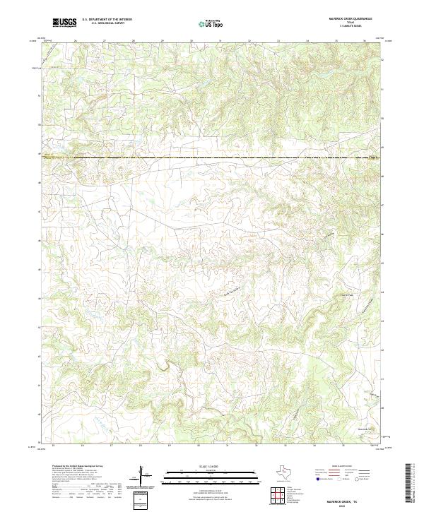
2022 Map of Maverick Creek
USGS Topo · Published 2022About this map
The Kent Co Scurry Co boundary line bisects this landscape of deeply carved draws and canyons in West Texas. The terrain is defined by a series of significant drainage systems, including Maverick Cr in the north and the converging waters of Rough Cr and Little Rough Cr to the southwest. These ephemeral watercourses have sculpted a complex network of topographical features such as Cox Hollow and the more southern South Cox Hollow.
Find a feature on this map
15 named features on this map. Tap any name to fly to it.
Don’t see what you’re looking for? This feature index may not catch every label — zoom into the map to look around manually.
Map Details
Editions of this 2022 Maverick Creek Map
This is the sole edition of this map. No revisions or reprints were ever made.
Other maps of this area

1932 · Camp Springs
USGS Topo · 1:62,500

1954 · Lloyd Mountain
USGS Topo · 1:24,000

1954 · Brand
USGS Topo · 1:24,000

1954 · Lubbock
USGS Topo · 1:250,000

1954 · Big Spring
USGS Topo · 1:250,000

1958 · Big Spring
USGS Topo · 1:250,000

1969 · Camp Springs
USGS Topo · 1:24,000

1969 · Maverick Creek
USGS Topo · 1:24,000
1969 · Hudd
USGS Topo · 1:24,000

1969 · Cooper Mountain
USGS Topo · 1:24,000