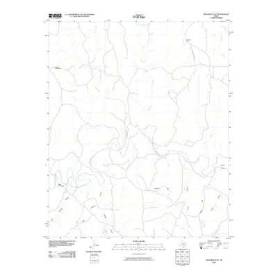
2010 Map of Maverick Flat
USGS Topo · Published 2010About this map
The South Wichita River winds through this rugged portion of Knox County, defining a landscape of deep canyons and isolated mesas. Named drainages like Honey Creek and Salt Creek cut through the terrain, feeding into the river as it meanders past Glover Bend. The topographic relief is marked by prominent elevations such as Hunter Mountain and Bald Mountain, while the southern reaches are dominated by a complex network of canyons including Getaway Canyon, Smelter Canyon, and Panther Canyon.
Find a feature on this map
17 named features on this map. Tap any name to fly to it.
Don’t see what you’re looking for? This feature index may not catch every label — zoom into the map to look around manually.
Map Details
Editions of this 2010 Maverick Flat Map
This is the sole edition of this map. No revisions or reprints were ever made.
Other maps of this area

1954 · Lubbock
USGS Topo · 1:250,000

1954 · Wichita Falls
USGS Topo · 1:250,000

1958 · Wichita Falls
USGS Topo · 1:250,000

1966 · Truscott North
USGS Topo · 1:24,000

1966 · Truscott South
USGS Topo · 1:24,000

1966 · Ox Yoke Creek
USGS Topo · 1:24,000

1966 · Big Four Ranch
USGS Topo · 1:24,000

1966 · Maverick Flat
USGS Topo · 1:24,000

1966 · Lowrance Mountain
USGS Topo · 1:24,000

1967 · Cedar Mountain
USGS Topo · 1:24,000