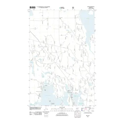
2011 Map of Max
USGS Topo · Published 2011About this map
Max sits at the northern edge of this Northwoods landscape, where the Max Post Office remains a central landmark for this rural Itasca County community. The area is defined by its intricate water systems, including the sprawling Cut Foot Sioux Lake, Little Cut Foot Sioux Lake, and the larger Lake Winnibigoshish to the southwest. The landscape is heavily managed for recreation and forestry, evidenced by the high concentration of public spaces like the Williams Narrows Campground and Picnic Area, West Seelye Campground, and the Mosomo Point Camp and Picnic Area.
Find a feature on this map
39 named features on this map. Tap any name to fly to it.
Don’t see what you’re looking for? This feature index may not catch every label — zoom into the map to look around manually.
Map Details
Editions of this 2011 Max Map
This is the sole edition of this map. No revisions or reprints were ever made.
Other maps of this area

1919 · Max
USGS Topo · 1:62,500

1954 · Bemidji
USGS Topo · 1:250,000

1954 · Hibbing
USGS Topo · 1:250,000

1957 · Bemidji
USGS Topo · 1:250,000

1957 · Hibbing
USGS Topo · 1:250,000

1958 · Bemidji
USGS Topo · 1:250,000

1958 · Hibbing
USGS Topo · 1:250,000

1964 · Hibbing
USGS Topo · 1:250,000

1970 · Bowstring Lake
USGS Topo · 1:24,000
1970 · Little Ball Club Lake
USGS Topo · 1:24,000