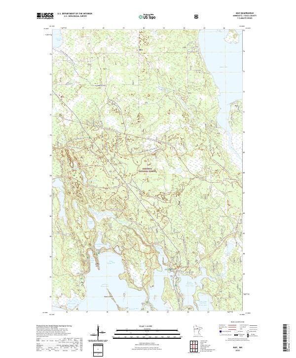
2022 Map of Max
USGS Topo · Published 2022About this map
Chippewa National Forest encompasses the vast majority of this area, showcasing a landscape defined by an intricate network of waterways and recreational trails. The settlement of Max sits in the northern reaches, while the southern portion of the map is dominated by the large expanse of Cut Foot Sioux Lake, including West Seelye Bay and East Seelye Bay. The geography is notably shaped by glacial activity, evidenced by the numerous lakes like Sand Lake, Lake Roosevelt, and Sunken Lake that dot the wooded terrain.
Find a feature on this map
60 named features on this map. Tap any name to fly to it.
Don’t see what you’re looking for? This feature index may not catch every label — zoom into the map to look around manually.
Map Details
Editions of this 2022 Max Map
This is the sole edition of this map. No revisions or reprints were ever made.
Other maps of this area

1919 · Max
USGS Topo · 1:62,500

1954 · Bemidji
USGS Topo · 1:250,000

1954 · Hibbing
USGS Topo · 1:250,000

1957 · Bemidji
USGS Topo · 1:250,000

1957 · Hibbing
USGS Topo · 1:250,000

1958 · Bemidji
USGS Topo · 1:250,000

1958 · Hibbing
USGS Topo · 1:250,000

1964 · Hibbing
USGS Topo · 1:250,000

1970 · Bowstring Lake
USGS Topo · 1:24,000
1970 · Little Ball Club Lake
USGS Topo · 1:24,000