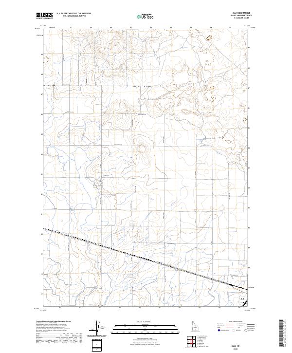
2023 Map of Max
USGS Topo · Published 2023About this map
Agricultural irrigation networks and rural townships define the landscape of Minidoka County in this recent survey. The terrain is marked by a precise grid of county roads, such as 1500 North Rd and 600 East Rd, which facilitate access to the vast farming tracts common in this part of Idaho. Water management is the central geographic feature of the region, evidenced by the intricate system of drainage canals including C Main Drain, D Main Drain, and B Main Drain. These man-made features work in tandem with natural depressions like Rim Lake and German Lake to manage the local water table for agricultural production. Small residential clusters, such as those along S Crystal Dr, are scattered throughout the sections, reflecting the modern settlement pattern of the Snake River Plain where heritage farmsteads intersect with contemporary development.
Find a feature on this map
35 named features on this map. Tap any name to fly to it.
Don’t see what you’re looking for? This feature index may not catch every label — zoom into the map to look around manually.
Map Details
Editions of this 2023 Max Map
This is the sole edition of this map. No revisions or reprints were ever made.
Other maps of this area

1954 · Pocatello
USGS Topo · 1:250,000

1958 · Pocatello
USGS Topo · 1:250,000

1959 · Lake Walcott
USGS Topo · 1:62,500

1964 · Rupert NW
USGS Topo · 1:24,000

1964 · Acequia
USGS Topo · 1:24,000

1972 · Community Lake
USGS Topo · 1:24,000

1972 · Minidoka
USGS Topo · 1:24,000

1972 · Max
USGS Topo · 1:24,000
1972 · Norland
USGS Topo · 1:24,000
1972 · Brigham Point
USGS Topo · 1:24,000