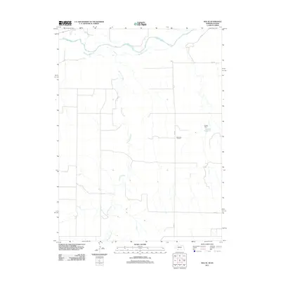
2011 Map of Max SE
USGS Topo · Published 2011About this map
The Republican River flows across the northern edge of this high plains landscape, while Burntwood Creek carves a long, winding path southward through the terrain. This rural area on the Nebraska-Kansas border is defined by its water sources and a sparse network of county roads like 1st Ave and 3rd Ave. The map captures the quiet character of Rawlins County in the early 2010s, where the few landmarks are tied to the local land and history. The West Union Cemetery stands as a focal point for genealogical interest, while the Golding Dam and Golding Reservoir indicate the ongoing importance of water management in this agricultural region. Minor tributaries like Indian Creek further mark the drainage patterns that have shaped the settlement and use of this prairie land over generations.
Find a feature on this map
9 named features on this map. Tap any name to fly to it.
Don’t see what you’re looking for? This feature index may not catch every label — zoom into the map to look around manually.
Map Details
Editions of this 2011 Max SE Map
This is the sole edition of this map. No revisions or reprints were ever made.
Other maps of this area

1950 · Mc Donald
USGS Topo · 1:62,500

1951 · Mc Donald
USGS Topo · 1:62,500

1951 · Atwood
USGS Topo · 1:62,500

1954 · McCook
USGS Topo · 1:250,000

1954 · Goodland
USGS Topo · 1:250,000

1956 · Goodland
USGS Topo · 1:250,000

1957 · McCook
USGS Topo · 1:250,000

1957 · Goodland
USGS Topo · 1:250,000

1958 · McCook
USGS Topo · 1:250,000

1962 · Trenton SW
USGS Topo · 1:24,000