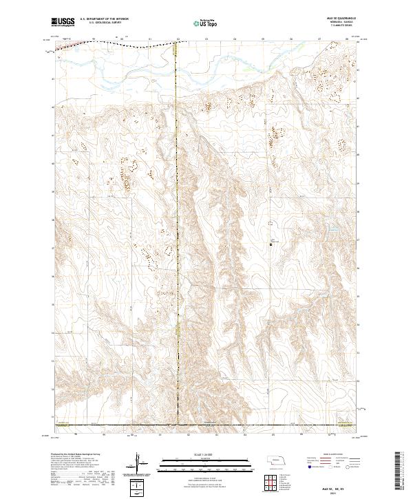
2021 Map of Max SE
USGS Topo · Published 2021About this map
West Union Cem serves as a quiet landmark in this high-plains landscape where the borders of Nebraska and Kansas meet. The terrain is defined by the transition between the plateau and the drainage systems of the Republican River valley, marked by a systematic grid of section lines and rural thoroughfares such as Rd 707 and Ave 348. The boundary between Dundy and Hitchcock counties bisects the western half of the sheet, illustrating the organized land division typical of the Great Plains. Water is a vital element in this arid environment, represented by the small catchments of Golding Reservoir. This survey highlights the sparse but deliberate footprint of human settlement, consisting primarily of isolated ranch roads and cemetery sites that have anchored the local community for generations.
Find a feature on this map
23 named features on this map. Tap any name to fly to it.
Don’t see what you’re looking for? This feature index may not catch every label — zoom into the map to look around manually.
Map Details
Editions of this 2021 Max SE Map
This is the sole edition of this map. No revisions or reprints were ever made.
Other maps of this area

1950 · Mc Donald
USGS Topo · 1:62,500

1951 · Mc Donald
USGS Topo · 1:62,500

1951 · Atwood
USGS Topo · 1:62,500

1954 · McCook
USGS Topo · 1:250,000

1954 · Goodland
USGS Topo · 1:250,000

1956 · Goodland
USGS Topo · 1:250,000

1957 · McCook
USGS Topo · 1:250,000

1957 · Goodland
USGS Topo · 1:250,000

1958 · McCook
USGS Topo · 1:250,000

1962 · Trenton SW
USGS Topo · 1:24,000