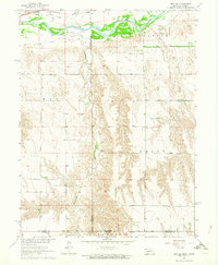
1962 Map of Max SE
USGS Topo · Published 1964About this map
The Republican River meanders across the northern border of this landscape, its wide floodplain carving through the Nebraska-Kansas borderlands. Just south of the river, the Chicago Burlington and Quincy railroad follows the valley corridor, serving as the primary transit artery for the region's agricultural output. The terrain is defined by the deep incisions of Burntwood Creek and its tributaries, which create a complex drainage pattern across the Max, Stratton, and Union townships. Local landmarks such as the West Union Cem and another Cem provide specific points of interest for genealogical research. A small industrial footprint is noted with a Gravel Pit near the river, while the map's southern edge is defined by the Base Line at the Kansas state boundary, where Rawlins Co Kansas meets the Nebraska counties of Dundy and Hitchcock.
Find a feature on this map
17 named features on this map. Tap any name to fly to it.
Don’t see what you’re looking for? This feature index may not catch every label — zoom into the map to look around manually.
Map Details
Editions of this 1962 Max SE Map
This is the sole edition of this map. No revisions or reprints were ever made.
Other maps of this area

1950 · Mc Donald
USGS Topo · 1:62,500

1951 · Mc Donald
USGS Topo · 1:62,500

1951 · Atwood
USGS Topo · 1:62,500

1954 · McCook
USGS Topo · 1:250,000

1954 · Goodland
USGS Topo · 1:250,000

1956 · Goodland
USGS Topo · 1:250,000

1957 · McCook
USGS Topo · 1:250,000

1957 · Goodland
USGS Topo · 1:250,000

1958 · McCook
USGS Topo · 1:250,000

1962 · Trenton SW
USGS Topo · 1:24,000