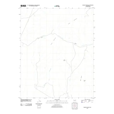
2010 Map of Maxson Crater
USGS Topo · Published 2010About this map
The Santa Fe Trl cuts across the northwest corner of this Mora County landscape, marking a historic corridor of movement through the high plains of New Mexico. The terrain is dominated by the volcanic and mountainous features of the Turkey Mountains, including the prominent Maxson Crater and Baldy Mountain. These geological landmarks rise above a network of seasonal drainage systems, such as Arroyo Tierra Blanca and Cottonwood Creek, which converge near Curry Canyon. A notable infrastructure element is the Horse Lake Dam, which regulates local water resources in an otherwise arid environment. The presence of the Cities Service 1 Fort Union site suggests industrial or resource extraction activity in the late 20th century, contrasting with the ancient volcanic topography and the legacy of early western migration trails.
Find a feature on this map
12 named features on this map. Tap any name to fly to it.
Don’t see what you’re looking for? This feature index may not catch every label — zoom into the map to look around manually.
Map Details
Editions of this 2010 Maxson Crater Map
This is the sole edition of this map. No revisions or reprints were ever made.
Other maps of this area

1889 · Las Vegas
USGS Topo · 1:125,000

1891 · Las Vegas
USGS Topo · 1:125,000

1892 · Watrous
USGS Topo · 1:125,000

1893 · Las Vegas
USGS Topo · 1:125,000

1894 · Watrous
USGS Topo · 1:125,000

1954 · Santa Fe
USGS Topo · 1:250,000

1954 · Raton
USGS Topo · 1:250,000

1958 · Raton
USGS Topo · 1:250,000

1958 · Santa Fe
USGS Topo · 1:250,000

1963 · Fort Union
USGS Topo · 1:24,000