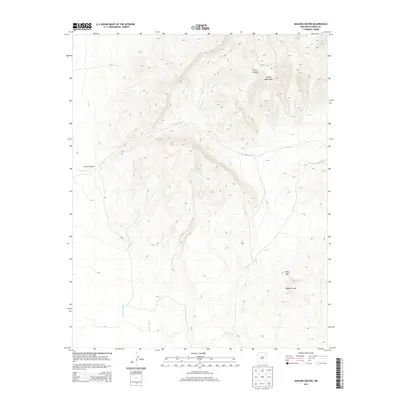
2013 Map of Maxson Crater
USGS Topo · Published 2013About this map
Maxson Crater defines the southeastern landscape of this portion of Mora County, serving as a prominent volcanic landmark near the elevated peaks of the Turkey Mountains. The terrain is deeply incised by a series of ephemeral drainages and canyons that dictate the movement of water and travel across this high-elevation environment. Significant watercourses such as Arroyo Tierra Blanca, Arroyo Lyman, and Arroyo Needham snake through the northern and western sections, while Curry Canyon and Cottonwood Cr emphasize the complex erosional patterns of the region. This 2013 survey illustrates a landscape largely shaped by its geologic origins, with the elevation rising toward Baldy Mtn and the broader mountain range, while Dog Cr drains the south-central reaches. The area remains dominated by natural topographical features, highlighting the geological transition from volcanic craters to rugged mountain drainages.
Find a feature on this map
9 named features on this map. Tap any name to fly to it.
Don’t see what you’re looking for? This feature index may not catch every label — zoom into the map to look around manually.
Map Details
Editions of this 2013 Maxson Crater Map
This is the sole edition of this map. No revisions or reprints were ever made.
Other maps of this area

1889 · Las Vegas
USGS Topo · 1:125,000

1891 · Las Vegas
USGS Topo · 1:125,000

1892 · Watrous
USGS Topo · 1:125,000

1893 · Las Vegas
USGS Topo · 1:125,000

1894 · Watrous
USGS Topo · 1:125,000

1954 · Santa Fe
USGS Topo · 1:250,000

1954 · Raton
USGS Topo · 1:250,000

1958 · Raton
USGS Topo · 1:250,000

1958 · Santa Fe
USGS Topo · 1:250,000

1963 · Fort Union
USGS Topo · 1:24,000