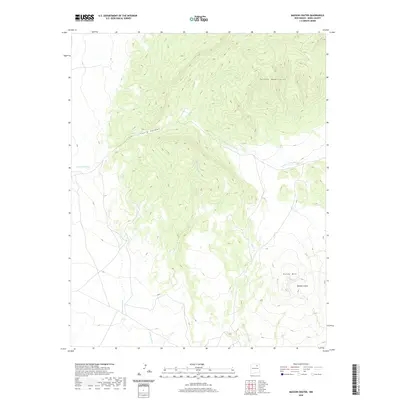
2020 Map of Maxson Crater
USGS Topo · Published 2020About this map
Maxson Crater and the surrounding volcanic field dominate this portion of Mora County. The landscape is defined by the high elevations of the Turkey Mountains and the prominent peak of Baldy Mtn, which overlook a network of seasonal drainage systems. Water distribution across this arid environment is traced through several distinct watercourses, including Arroyo Tierra Blanca, Arroyo Needham, and Cottonwood Cr. These features illustrate the natural drainage patterns that have shaped the local topography over millennia.
Find a feature on this map
9 named features on this map. Tap any name to fly to it.
Don’t see what you’re looking for? This feature index may not catch every label — zoom into the map to look around manually.
Map Details
Editions of this 2020 Maxson Crater Map
This is the sole edition of this map. No revisions or reprints were ever made.
Other maps of this area

1889 · Las Vegas
USGS Topo · 1:125,000

1891 · Las Vegas
USGS Topo · 1:125,000

1892 · Watrous
USGS Topo · 1:125,000

1893 · Las Vegas
USGS Topo · 1:125,000

1894 · Watrous
USGS Topo · 1:125,000

1954 · Santa Fe
USGS Topo · 1:250,000

1954 · Raton
USGS Topo · 1:250,000

1958 · Raton
USGS Topo · 1:250,000

1958 · Santa Fe
USGS Topo · 1:250,000

1963 · Fort Union
USGS Topo · 1:24,000